Thursday, March 12, 2009 12:46:30 AM:
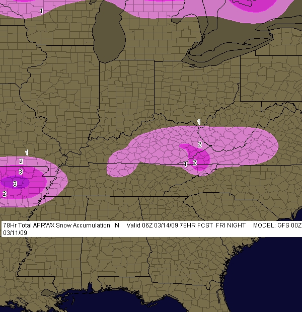
This morning the NAM suggest a light wintry mix across mostly the southern and eastern areas of Ky. for Thursday into Friday.
This latest info also has much lighter amounts than yesterday. Generally maximum amounts of 1" and only in eastern Ky. The
radar and model match up very well at time of this typing. GFS generally has an inch south of I-64 and east of 65. Historically
the NAM is to light on precip and the GFS is to heavy. Taking all this into consideration here is my updated Wintry Weather
Outlook for Thur.-Fri.
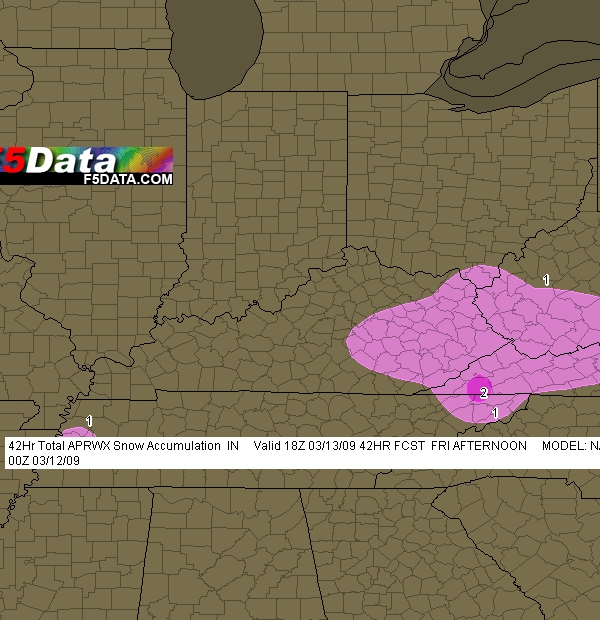
There will be a mix of precipitation with total accums as follows:
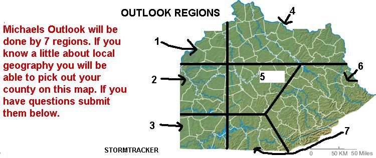
REGIONS 1, 2, 3 and 4: Less than 1"
REGIONS 5, 6 and 7: Around 1" . The greatest liklihood and highest totals will be Region 6.
No further updates on this system planned.